Be at Redstone Cyclery at 5:30 and ready to caravan. We'll be driving 1/2 hour or so to Peaceful Valley and riding there. The ride will be Middle St Vrain (or Coney Creek, we'll see) to the wilderness boundary then down Buchanan Pass trail.
This ride will be:
A)wet, I mean really wet. Potential drivetrain wrecker. Lots of water crossings and some mud at the top.
B)really technical. Technical climbing on wet jeep road rocks, then down one of the most blissful and technical trails around.
C)high. We'll be riding between 8 and 10 thousand feet.
D)trouble. something will inevitably go wrong and we'll probably get back to the car after dusk. If you have a light, you should bring it :)
Sunday, July 12, 2009


Thursday, July 09, 2009
big wheeled singlespeed goodness
Check out this baby we put together recently for Art. Art sent Redstone the frame and said build 'er up. Sweet!


Tuesday, July 07, 2009
Picture Rock trail day Tuesday Ride
Thanks for all that came out for this weeks Tuesday Ride, trail work edition. We were able to contribute 30 hour of labor on PR - great job! We had a good crew that rode in to the worksite from Lyons.  There were/are a couple of spots by the silo on the PR trail where springs had sprung this spring and muddied and rutted up the trail. Our mission tonight was to go in to help Open Space staff armor those sections of trail. If you've seen the sidewalk pavers at Heil, then you know what I'm talking about. I now have a much greater appreciation for all of the work the county puts into armoring. Big flat pavers with vertical pitched rocks in between are definitely easier to ride over than to build!
 We were working on 3 sections tonight. One was finished right after we arrived, one we finished about 75% and the 3rd got mostly doug out.
 There were/are a couple of spots by the silo on the PR trail where springs had sprung this spring and muddied and rutted up the trail. Our mission tonight was to go in to help Open Space staff armor those sections of trail. If you've seen the sidewalk pavers at Heil, then you know what I'm talking about. I now have a much greater appreciation for all of the work the county puts into armoring. Big flat pavers with vertical pitched rocks in between are definitely easier to ride over than to build!
 We were working on 3 sections tonight. One was finished right after we arrived, one we finished about 75% and the 3rd got mostly doug out.
 We shut 'er down around 8:20 so we'd have enough daylight to ride out. The descent was smooth and swoopy fun all the way. The dirt was perfect too. A short but great ride.
This is an intersection that I've become super familiar with in the last few months. I love the addition.

The sections we worked on were all on the brief part of the trail between the quarry/old car and the silo. We are welcome to feedback, too. We want Picture Rock to be used by many for long times to come. If anyone is interested, we'll be doing another 2 or 3 of these work days this summer. Stay tuned.
Buchanan Pass next week!
Monday, July 06, 2009
The Breck Epic is Underway
and friends of Redstone are racing. So far after the prologue and stage 1, local favorite lady and Dale's/Spot racer Jen Gersbach has a 7 minute lead over 2nd place in Women Solo. Chad from Dale's Spot and Brian Riepe from Mountain Flyer already have a 20 min lead in the relay division.
If you want to stay abreast of what's happening, check MTB Race News for the scoop or CJ Timing for up to date stage and GC results.
TDF got nothing on the Breck Epic!
If you want to stay abreast of what's happening, check MTB Race News for the scoop or CJ Timing for up to date stage and GC results.
TDF got nothing on the Breck Epic!
Trailwork on Tuesday!
Here's the details for this weeks Tuesday Night Ride...
Hello Trail Stewards with Redstone Cyclery,
Thank you for volunteering with Boulder County Parks and Open Space. Following is a project information outline for the trail maintenance volunteer project on Tuesday July 7th. You will be working on the Picture Rock Trail along with County staff.
Trail Maintenance Project at Heil Ranch:
Overview: Your assistance will help improve hiking and multi-purpose trails at Heil Ranch. Due to the recent precipitation that we have been receiving, multiple natural springs have been developing. In order to mitigate the moisture we will be armoring sections of the trail that are impacted by these springs. We will be using hand tools to complete this work, and will be several miles away from the trailhead.
Schedule: Please arrive at the Picture Rock Trailhead at 5:30 (see directions below). You will then bike up the Picture Rock Trail to the silo where County Staff will greet you. We will work on the trail until 8:00 - 8:30, giving you enough time to make it back to the trailhead before dark.
Directions: To the Picture Rock Trailhead
Travel through the town of Lyons to the intersection of Highway 36 (Main Street) and Highway 7 (5th Ave.) Turn south onto Highway 7 (towards Allenspark). Travel 1 mile and take a left on Old St. Vrain Rd. You will then take a left on Red Gulch Rd. (about ¼ mile); the parking lot will be on your right about ¼ mile after the turn.
Weather: Weather in July is usually warm and sunny and afternoon thunderstorms are always possible. I would suggest checking the forecast before the project at www.noaa.org and search Lyons, CO. Even if the forecast predicts bad weather, please plan on attending. We will try to work in slightly inclement weather (light rain, wind). If we do decide to postpone this project, I will contact Dave as soon as possible.
What To Bring:
What You Should Bring-
Drinking water (2-3 liters)
Small backpack
Snack
Sunscreen
Work gloves (if you have them)
Sturdy shoes/boots
Layers of clothes
Rain gear
Binoculars or camera (optional)
I will bring-
Light snacks
Work gloves
A jug of water
First aid kit
All necessary tools
Hello Trail Stewards with Redstone Cyclery,
Thank you for volunteering with Boulder County Parks and Open Space. Following is a project information outline for the trail maintenance volunteer project on Tuesday July 7th. You will be working on the Picture Rock Trail along with County staff.
Trail Maintenance Project at Heil Ranch:
Overview: Your assistance will help improve hiking and multi-purpose trails at Heil Ranch. Due to the recent precipitation that we have been receiving, multiple natural springs have been developing. In order to mitigate the moisture we will be armoring sections of the trail that are impacted by these springs. We will be using hand tools to complete this work, and will be several miles away from the trailhead.
Schedule: Please arrive at the Picture Rock Trailhead at 5:30 (see directions below). You will then bike up the Picture Rock Trail to the silo where County Staff will greet you. We will work on the trail until 8:00 - 8:30, giving you enough time to make it back to the trailhead before dark.
Directions: To the Picture Rock Trailhead
Travel through the town of Lyons to the intersection of Highway 36 (Main Street) and Highway 7 (5th Ave.) Turn south onto Highway 7 (towards Allenspark). Travel 1 mile and take a left on Old St. Vrain Rd. You will then take a left on Red Gulch Rd. (about ¼ mile); the parking lot will be on your right about ¼ mile after the turn.
Weather: Weather in July is usually warm and sunny and afternoon thunderstorms are always possible. I would suggest checking the forecast before the project at www.noaa.org and search Lyons, CO. Even if the forecast predicts bad weather, please plan on attending. We will try to work in slightly inclement weather (light rain, wind). If we do decide to postpone this project, I will contact Dave as soon as possible.
What To Bring:
What You Should Bring-
Drinking water (2-3 liters)
Small backpack
Snack
Sunscreen
Work gloves (if you have them)
Sturdy shoes/boots
Layers of clothes
Rain gear
Binoculars or camera (optional)
I will bring-
Light snacks
Work gloves
A jug of water
First aid kit
All necessary tools
Sunday, July 05, 2009
July 5 musings


I was going to go deep and type up a big ol post regarding the internet, narcissism, annonimity and cowardice. But I decided against it. After all, here it is, the day after our own Independence Day. Our country was founded not on annonimity, but knowing exactly who we are. Not on narcissism, but the need to help others to a better life. Founded not on cowardice but on bravery. Redstone followers, I hope all of these characteristics can be found in you. That is all.
Enjoy your independence as well as your Independence. I'm going riding.
Thursday, July 02, 2009
Intense Tracer VP for sale

I have absolutely loved my time with my large Intense Tracer VP but the time has come to part ways. It is an absolutely fantastic bike. In many ways, it's been the holy grail that I've seeked for many years. It climbs like a billy goat on crack and descends like a hot rock on a buttery slope. Without a doubt, this bike has made me a better rider.
Why move on, you ask? I dunno. Time for something different. Got my eyes on a 5 Spot now as I'd like to see how it compares. We shall see.
Give me a call or email (dave@redstonecyclery.com) if you're interested. I'm happy to part with this bike as a frame plus a few parts (frame/shock/headset/Thomson seatpost, XTR front der - $1675), or the whole shebang, XTR build and all ($3100). The frame will have the standard Intense warranty as well.
long way in
This morning, I took the long way to work. I rode down the hill a bit, then hung a righty on Apple Valley Road. Destination Hall Ranch. I had about 45 minutes - just enough time for me to do the "up and over." Up Antelope to the junction, then left to the top, down the rock garden, and back to town. I wasn't feeling too hot but it did not dissapoint. Antelope has some nice erosion on it now. The rock garden always did have erosion but it's even better or worse now, depending on how you look at it. Tougher, for sure.
Sure is green, though...
And the commuter sandals handled Hall alright, too.

Yay commute.
Sure is green, though...

And the commuter sandals handled Hall alright, too.

Yay commute.
Wednesday, July 01, 2009
Some Tuesday for Thursday
Here's a few shots from this weeks Tuesday Night Ride in the forest. Good riding, good scenery, smiles, and good beers.


Remember, next week is Trail Work on Picture Rock. We'll be leaving the shop around 5. If you can't make it on time, just ride up - we'll be doing some work right by the silo, just over 2 miles in.


Remember, next week is Trail Work on Picture Rock. We'll be leaving the shop around 5. If you can't make it on time, just ride up - we'll be doing some work right by the silo, just over 2 miles in.
stars and bars baby. Or star and argyle
This Friday is Independence Day, July 4, as well as the first day of the Tour De France. To celebrate, our friends at Pearl Izumi (sponsors of the Garmin/Chipotle team) have come up with this sweet David Zabriske special red white and blue ltd edition jersey. We got a very limited amount in for the 4th. Get some!


Monday, June 29, 2009
L'epic avec JG: musings de la musette

He all, wanted to pass along the chance to follow one of the newest redstoners through the Breck Epic.
The Breck Epic, July 5-10 2009, is a 6-day ultra-endurance mountain bike stage race held in the sprawling backcountry of Breckenridge, Colorado. After a 10-mile time-trial on day one athletes will contest 5 subsequent stages spending 4-8 hours on course each day, most of it over 10,000 feet...check out the course profile HERE.
The race does have a tender side: Proceeds from the inaugural “B.E.” benefit local open space initiatives and trail improvements. Registration for 2009 is still open!
Join us at the Oskar Blues Brews & Bikes Blog for L'epic avec JG: musings de la musette. DPA/Spot Brand Bikes pro Jen Gersbach will provide day-by-day insight into what it takes to tackle one of Colorado's most grueling bike races. Along with Jen's smile & insight we'll keep you in the action with images from www.photo-cycle.com, Tour de France banter & contests as well as many gonzo giveaways & antics as we can muster the energy to throw your way. The race starts on July 5th but preparation has already begun, stick with us as we prepare to tackle Colorado's biggest & baddest Mountain Bike Stage Race. We'll also be posting updates via the Oskar Blues Facebook & Twitter pages, so check them out as well.
Keepin' it in the family....we also have SPOT homeboy Jeff Carter's SPOT BRAND blog HERE.

Sunday, June 28, 2009
Tuesday Ride Schedule
Tuesday, June 30 - 5:30pm at the bike shop for Coulson Gulch out and back. Or maybe we'll do it as a loop.
Tuesday July 7 - trailwork on Picture Rock. We will be armoring trail and doing some finish work by the silo. Bike shop at 5. Ride to the silo for work. If you can't make it to the shop at 5, come join us when you can. Please RSVP to dave@redstonecyclery for this one so we can make sure we have enough tools.
Tuesday July 14 - Buchanan Pass. Bike shop at 5:30.
Tuesday July 21 - Bike shop at 5:30. 20 min or so drive. fun stuff.
Tuesday July 7 - trailwork on Picture Rock. We will be armoring trail and doing some finish work by the silo. Bike shop at 5. Ride to the silo for work. If you can't make it to the shop at 5, come join us when you can. Please RSVP to dave@redstonecyclery for this one so we can make sure we have enough tools.
Tuesday July 14 - Buchanan Pass. Bike shop at 5:30.
Tuesday July 21 - Bike shop at 5:30. 20 min or so drive. fun stuff.
Gold Tour 09 recap
[EDIT - I think my photo uploading skillz are lacking. Click in the pic for a full sized view. Some of them got cut off.]
As part of our big rides summer tour, we ventured towards Gold Ridge for stop number one on the tour. The goal was a big ride. I don't think anyone left dissapointed.
We started with the days most major climb. The climb is an old jeep road that meanders alongside a beauty of a creek. The road was closed to motorized 20 or so years ago and continues to grow more single every year. I've been riding it for 11 years or so and am still amazed every spring. At this particular moment after all of the rain we've been having, the stream was a raging river, full of rapids with some spill over onto the road.

Normally, all of the road is dry except for one spot where the river runs over every spring. It was a bit different this Spring. The river wasn't just running over, it had fully overtaken anything left that resembled a road or trail.

Fortunately, there was a way around

I normally dislike hiking in mega steep terrain over volkswagon sized boulders, so I figured I'd try to walk up the road/creek. Normally, it's only 6 to 8 inches deep. On this occasion, I was up to my nuts a couple of times in deep, swift water. Turning around looking back down the road, here's what it looks like right where the creek spills over

The climb continued to be a wet one for a while.

And then, we got to one of the most dangerous parts of the ride. It was time to cross the creek. Normally, you can shoulder your bike and walk thru, as the crossing is at an area where the creek is wide and relatively flat. Not this time. There was the possiblity of carnage and we saw an omen.

We opted for the log. There's bridge over the river a bit upstream. It's a narrow log, about 3-4' off the water and is slippery. We went with the assembly line option. Thank goodness for teamwork.

After an hour and 45 minutes of climbing and adventure, we reached the top of the days first big ascent.

The views didn't suck. We also had our first mechanical. Lee snapped off his derailleur, but we were able to fix it with an assortment of zip ties. Originally thinking Lee would have to head back down the hill, we rode for a bit and realized that not only was he still able to use his 3 rings on the crank, but Lee would be able to ride the remaining 4 hours to finish the ride. Thanks for the trail fix, Brian!

The derailleur wasn't the only carnage at that point either. So long sucker bee!

Some of the riders had gone ahead. We found Jen perched in a tree downing a snack.

Then we were in for more descending.

and more climbing.

and more descending.

Floating thru big open meadows

and some technical terrain, too

But we new that the days 2nd biggest descent would not last forever and we'd have to start climbing again. Back to the road riding. Road pictured here.

Remember, it's not a mountain bike ride unless you are hiking. We were about 4 hours in at this point.

After some more uppy downy singletrack, we were back to climbing in earnest again. Last climb of the day.

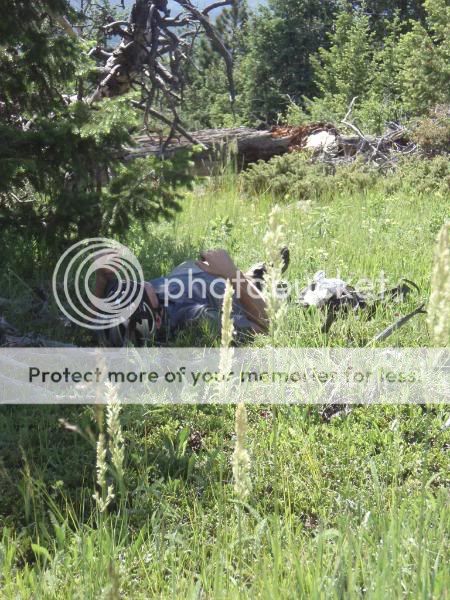
We had a snackbreak and naptime at the top. Just like kindergarten but without the mats and the graham crackers. This was 5.5 hours plus at this point.
Another crappy road section led us back to our vehicles

Cardoor to cardoor was 6 hours and 15 minutes. I think everyone wasn't feeling too bad at this point. It didn't hit me until after a couple of Go Fasts, a Dale's Pale Ale and dinner. Damn, I was tired.
Woke up feeling it a bit today, but still managed to make it out for just over an hour with Dirty Doug. After a quick post ride dip in the river, I was feeling good as new. Well, sort of.
See you Tuesday for another adventure!
As part of our big rides summer tour, we ventured towards Gold Ridge for stop number one on the tour. The goal was a big ride. I don't think anyone left dissapointed.
We started with the days most major climb. The climb is an old jeep road that meanders alongside a beauty of a creek. The road was closed to motorized 20 or so years ago and continues to grow more single every year. I've been riding it for 11 years or so and am still amazed every spring. At this particular moment after all of the rain we've been having, the stream was a raging river, full of rapids with some spill over onto the road.

Normally, all of the road is dry except for one spot where the river runs over every spring. It was a bit different this Spring. The river wasn't just running over, it had fully overtaken anything left that resembled a road or trail.


Fortunately, there was a way around

I normally dislike hiking in mega steep terrain over volkswagon sized boulders, so I figured I'd try to walk up the road/creek. Normally, it's only 6 to 8 inches deep. On this occasion, I was up to my nuts a couple of times in deep, swift water. Turning around looking back down the road, here's what it looks like right where the creek spills over

The climb continued to be a wet one for a while.

And then, we got to one of the most dangerous parts of the ride. It was time to cross the creek. Normally, you can shoulder your bike and walk thru, as the crossing is at an area where the creek is wide and relatively flat. Not this time. There was the possiblity of carnage and we saw an omen.

We opted for the log. There's bridge over the river a bit upstream. It's a narrow log, about 3-4' off the water and is slippery. We went with the assembly line option. Thank goodness for teamwork.

After an hour and 45 minutes of climbing and adventure, we reached the top of the days first big ascent.

The views didn't suck. We also had our first mechanical. Lee snapped off his derailleur, but we were able to fix it with an assortment of zip ties. Originally thinking Lee would have to head back down the hill, we rode for a bit and realized that not only was he still able to use his 3 rings on the crank, but Lee would be able to ride the remaining 4 hours to finish the ride. Thanks for the trail fix, Brian!

The derailleur wasn't the only carnage at that point either. So long sucker bee!

Some of the riders had gone ahead. We found Jen perched in a tree downing a snack.

Then we were in for more descending.

and more climbing.

and more descending.

Floating thru big open meadows

and some technical terrain, too

But we new that the days 2nd biggest descent would not last forever and we'd have to start climbing again. Back to the road riding. Road pictured here.

Remember, it's not a mountain bike ride unless you are hiking. We were about 4 hours in at this point.

After some more uppy downy singletrack, we were back to climbing in earnest again. Last climb of the day.

We had a snackbreak and naptime at the top. Just like kindergarten but without the mats and the graham crackers. This was 5.5 hours plus at this point.

Another crappy road section led us back to our vehicles

Cardoor to cardoor was 6 hours and 15 minutes. I think everyone wasn't feeling too bad at this point. It didn't hit me until after a couple of Go Fasts, a Dale's Pale Ale and dinner. Damn, I was tired.
Woke up feeling it a bit today, but still managed to make it out for just over an hour with Dirty Doug. After a quick post ride dip in the river, I was feeling good as new. Well, sort of.
See you Tuesday for another adventure!
Friday, June 26, 2009
duzer does america
By now, I'm sure everyone has seen the youtube video of that dude doing some sick, sick, sick trials moves. Great bike handler, but he doesn't have much on this man. Ryan VanDuzer from Boulder, CO is riding from Oceanside, CA to Washington DC to raise money for Community Cycles and awareness for our dependency on cars. No biggie you say, plenty of folks have done that. Not on a 3 speed cruiser, though. Yep, cross country on a 3 speed cruiser towing a BOB trailer. That's dedication and bike love.


Wednesday, June 24, 2009
Tuesday Night Solstice-ish Ride
Man, what a great ride! We had daylight, we had night. We had bikes with broken parts, slow leakers, lights that didn't work, and we even managed to get off trail and freestyle it a bit. Oh, and rain, too. Wet rocks on technical trails. In a sense, just a great ride. The only thing that was a bummer was that Oskars was closed when we got there. So we had after hours at the shop with Dale's in a can and a bag of chips. Here's some shots from the the ride:


Monday, June 22, 2009
Lyons to Boulder Trail comments needed/open house!
Hey All, on Tues 6/23, there is an open house meeting for the Lyons to Boulder Regional Trail. This is a regional connector that will run loosely along the feeder canal that runs from Lyons to the Boulder Reservoir. 2 years ago we, as voters, approved an additional transportation tax (ie not open space) that provided for this connector specifically. It is meant not only as a recreational trail, but as something commuters could use off of the road to connect Lyons and rural parts of Boulder County to Boulder and beyond.
The open house is from 4pm to 8pm at Barn A of the Boulder County fairgrounds in Longmont. It will be a walk thru open house with no formal presentation. What does that mean? It means that they are soliciting feedback on the trail alignments they've come up with thus far. Boulder County has been soliciting information on this trail for months. They've come up with 3 different possible trail alignments. We have version A, version B, and version C to familiarize ourselves with. Take a look at the entire deal at the Lyons to Boulder Trail website. Please read over everything and be informed.
After reviewing all of the information, I think it'd be great if we all rallyed for option C. Option C will, without a doubt, be the most politically difficult option, but it is also the option with the least amount of existing road. Option A and B both line out alignment alternatives that use existing roads, dirt and paved. We want this to be a regional trail, not a route. I did not vote for that tax thinking we'd get some spraypaint on a road, let's do this right.
If you can't make the open house (and that's ok) make sure you send a email to Lyonstoboulder@bouldercounty.org. They are accepting public comments for a short period longer.
Here's a copy of the letter I sent. Feel free to copy. You'll have to change a couple of things, though :)
"Hello. First off want to say thanks for working on the Lyons to Boulder trail thus far. It's a huge project and we (Lyons area cyclists) are very appreciative of it. I'm a family man, a bike shop owner, a bicycle rider, and a resident of Lyons. Based on all of these things, plus relying on input from Lyons area bicycle commuters, I support option C.
Option C makes the most sense for several reasons:
Families - Option C has the least amount of existing passenger car and truck road possible. I understand there may be some small sections to get this completed, but we are looking for a trail that is not part of existing road - not a "route" of mostly existing roads. I want to feel safe if I take my family on a bike ride to Boulder Res. With a 6yo and a 3yo, I am not comfortable with alignments on the road.
Bike Shop Owner/resident of Lyons - The amount of people that will use this route is inversely proportionate to the amount of road. More road, less users. Less road, more users. More users of this regional trail would support my business and my town. Doing so would yeild more sales taxes for the state, the county, the town of Lyons, and RTD. This is one real area where transportation spending can yeild huge profitable benefits. Boulder County et all will be paid on the cost of construction. This is an investment.
Bicycle Rider/Commuter - The more I ride my bike on the road and drive my car on the road, the less I like biking on the road! I feel unsafe on the road and am looking for a seperated trail to use for commuting as well as recreation. The on road alignments are primarily on two lane/no shoulder roads or on existing dirt/farm roads. Neither are optimal for bicycle use. Please keep in mind that this trail will see a lot of use by night time commuters from Lyons and rural parts heading to Niwot, Gunbarrel, and Boulder. Less roads will make for safer night time passage for all.
Option C also meets the most objectives in the Draft Decision Matrix Summary. These objectives are:
*User Experience
*Safety
*Public Landowner Impact (ie the NCWCD will see improvements all along it's ditch)
*Connectivity
*Cost (it is important to look at the long range picture, not strictly the up front cost of building. Think investment).
I understand that there are several issues facing this trail, mostly with regard to land ownership and land management. The transportation tax that we passed that provided funding for this project meant that we are serious about connecting Boulder County via non automobile alternatives. Let's do it right."
Please, please, please, please get on this!
The open house is from 4pm to 8pm at Barn A of the Boulder County fairgrounds in Longmont. It will be a walk thru open house with no formal presentation. What does that mean? It means that they are soliciting feedback on the trail alignments they've come up with thus far. Boulder County has been soliciting information on this trail for months. They've come up with 3 different possible trail alignments. We have version A, version B, and version C to familiarize ourselves with. Take a look at the entire deal at the Lyons to Boulder Trail website. Please read over everything and be informed.
After reviewing all of the information, I think it'd be great if we all rallyed for option C. Option C will, without a doubt, be the most politically difficult option, but it is also the option with the least amount of existing road. Option A and B both line out alignment alternatives that use existing roads, dirt and paved. We want this to be a regional trail, not a route. I did not vote for that tax thinking we'd get some spraypaint on a road, let's do this right.
If you can't make the open house (and that's ok) make sure you send a email to Lyonstoboulder@bouldercounty.org. They are accepting public comments for a short period longer.
Here's a copy of the letter I sent. Feel free to copy. You'll have to change a couple of things, though :)
"Hello. First off want to say thanks for working on the Lyons to Boulder trail thus far. It's a huge project and we (Lyons area cyclists) are very appreciative of it. I'm a family man, a bike shop owner, a bicycle rider, and a resident of Lyons. Based on all of these things, plus relying on input from Lyons area bicycle commuters, I support option C.
Option C makes the most sense for several reasons:
Families - Option C has the least amount of existing passenger car and truck road possible. I understand there may be some small sections to get this completed, but we are looking for a trail that is not part of existing road - not a "route" of mostly existing roads. I want to feel safe if I take my family on a bike ride to Boulder Res. With a 6yo and a 3yo, I am not comfortable with alignments on the road.
Bike Shop Owner/resident of Lyons - The amount of people that will use this route is inversely proportionate to the amount of road. More road, less users. Less road, more users. More users of this regional trail would support my business and my town. Doing so would yeild more sales taxes for the state, the county, the town of Lyons, and RTD. This is one real area where transportation spending can yeild huge profitable benefits. Boulder County et all will be paid on the cost of construction. This is an investment.
Bicycle Rider/Commuter - The more I ride my bike on the road and drive my car on the road, the less I like biking on the road! I feel unsafe on the road and am looking for a seperated trail to use for commuting as well as recreation. The on road alignments are primarily on two lane/no shoulder roads or on existing dirt/farm roads. Neither are optimal for bicycle use. Please keep in mind that this trail will see a lot of use by night time commuters from Lyons and rural parts heading to Niwot, Gunbarrel, and Boulder. Less roads will make for safer night time passage for all.
Option C also meets the most objectives in the Draft Decision Matrix Summary. These objectives are:
*User Experience
*Safety
*Public Landowner Impact (ie the NCWCD will see improvements all along it's ditch)
*Connectivity
*Cost (it is important to look at the long range picture, not strictly the up front cost of building. Think investment).
I understand that there are several issues facing this trail, mostly with regard to land ownership and land management. The transportation tax that we passed that provided funding for this project meant that we are serious about connecting Boulder County via non automobile alternatives. Let's do it right."
Please, please, please, please get on this!
Tuesday Ride, 6/22 - Solstice Ride!
Ok, so this Tuesday isn't the longest day of the year, but it'll be the most daylight Tuesday Rides '09 sees so we're goin big. Bring your lights, aka LIGHTS MANDATORY this time. We'll be heading to the Sourdough universe again, although I have yet to really finalize the route. Bike shop at 5:30 and we'll hope to be riding by 6:15 or so. Light off until it gets dark, then we'll click our lights on and ride some more. It will be a late night.
This will not only be a day/night ride, but we'll be covering some really technical terrain. If riding hard technical rocky terrain in the dark is your bag, come on out!
This will not only be a day/night ride, but we'll be covering some really technical terrain. If riding hard technical rocky terrain in the dark is your bag, come on out!
Friday, June 19, 2009
Big Summer Ride Schedule
Seems like the Redstone crew and friends likes our big rides so much, we're going to start doing them once per month. We'll officially "end" them with our big season capper, the Big Fall Ride in September. These will be definite all day'ers. Meet at the shop at 9am and back for dinner. We'll see about finding some adventure, too, as all rides will be left to on trail interpretation and possible route exploration. Sound like your kind of fun? Sounds like my kind of fun. Read on.
Saturday June 27
The Gold Tour. Not Golden the town, but golden lakes and ridges between LHC and James Canyon. Good stuff. Not as brutal technically, but will have a legitimate crapload of climbing. To be honest, I'm too ascared to preride it. So I won't. 20 min from Lyons

Saturday July 25
Peaceful Tour of the Dick. How about almost everything between Peaceful Valley and Brainard lake? A little Buchanan Pass? Some SSV? Sure. Sourdough? You bet. Little Raven? Got it. We'll only get around 20 miles, but it's 20 miles of the rockiest, most technical trail around. Exhaustion guaranteed for all but the most excruciatingly fit. 30 min from Lyons

Saturday Aug 22
Wildcard. I've been contemplating climbing 3k' in vert to the top of a pass, then dumping down the backside just to see what's there for quite some time now. Every time I've attempted, it takes so long to get to the top, I'm always too tired for more climbing so I've turned around. I would love to do a loop on the other side, then back to the top of the pass. Once you're down the other side though, you are committed to a serious climb back up to the top o the pass. Think of it as a lollipop loop with a mystery flavor wrapper. 45 min drive from Lyons.
September date TBA, probably 26
Big Fall RideIV. We'll drop you off somewhere in the forest and you'll have to ride back to Lyons on as much dirt as possible. Last year was about 8hrs and folks were hurting. We're thinking of adding another hour or so this year. Just for fun.

Saturday June 27
The Gold Tour. Not Golden the town, but golden lakes and ridges between LHC and James Canyon. Good stuff. Not as brutal technically, but will have a legitimate crapload of climbing. To be honest, I'm too ascared to preride it. So I won't. 20 min from Lyons

Saturday July 25
Peaceful Tour of the Dick. How about almost everything between Peaceful Valley and Brainard lake? A little Buchanan Pass? Some SSV? Sure. Sourdough? You bet. Little Raven? Got it. We'll only get around 20 miles, but it's 20 miles of the rockiest, most technical trail around. Exhaustion guaranteed for all but the most excruciatingly fit. 30 min from Lyons
Saturday Aug 22
Wildcard. I've been contemplating climbing 3k' in vert to the top of a pass, then dumping down the backside just to see what's there for quite some time now. Every time I've attempted, it takes so long to get to the top, I'm always too tired for more climbing so I've turned around. I would love to do a loop on the other side, then back to the top of the pass. Once you're down the other side though, you are committed to a serious climb back up to the top o the pass. Think of it as a lollipop loop with a mystery flavor wrapper. 45 min drive from Lyons.
September date TBA, probably 26
Big Fall RideIV. We'll drop you off somewhere in the forest and you'll have to ride back to Lyons on as much dirt as possible. Last year was about 8hrs and folks were hurting. We're thinking of adding another hour or so this year. Just for fun.
Thursday, June 18, 2009
something for Friday - shots from this years Fat Tire Fest
So, the 9th annual Lyons Fat Tire Fest is dead and gone. And good times it was. Here's a few random shots, mostly from the Deathmarch on Crosier Mt.




Subscribe to:
Posts (Atom)